Document Archive
-
Timeline of Tadley & St Peter’s Church
-
Archaeology
-
Medieval Documents with mention of Tadley.
-
Other relevant documents inc. Heather’s research
-
St Peter’s Church
-
Portway Significance
-
Medieval Village Research (Heather)
-
Hampshire Archivists input
-
Maps and Lidar
-
Role of Detached Villages
-
Conclusions
Introduction
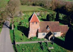
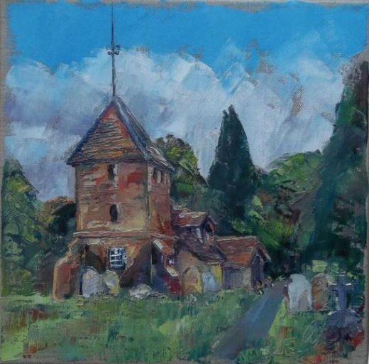
Tadley is designated in the National Monuments Record (England), now known as English Heritage Archive and the Archaeology and Historic Buildings Record as a ‘Deserted Mediaeval Village’. The parish church of St Peter’s stands alone amongst the fields, with most of modern Tadley (post 1600), now a town, situated about a mile to the east. One of Tadley and District History Society’s (TADS) projects is to discover the exact whereabouts of the original village. (1)
The potential existence of a medieval village, implicit in the the title of this project, derives from the relative isolation of St Peters Church, far from the older parts of Tadley and the well documented fact that Sir Henry Ludlow destroyed 12 houses in 1636. On this basis Tadley has been formally included in a list of lost villages. (1) However, it is possible that the houses were not collocated sufficiently to be described as a village or that even if a village did exist prior to 1636 it may not have been medieval in origin.
Evidence gathered by TADS includes a state paper that mentions the demolishing of a church house and other houses in 1636, archaeological finds indicating a ‘spread of medieval activity’ noted during cable work, aerial photographs of the surrounding fields taken from aircraft and a mobile mast, and a preliminary field walk of a copse behind the church to look for clues of habitation.(2)
At the present time photographs indicate a possible field system adjacent to Tadley Place and a ‘linear feature’ across a field between St Peter’s Church and Tadley Place. It seems logical that the original houses may have been dotted around the vicinity of the church and manor. However, the location of any medieval buildings have yet to be identified. While archaeological techniques, such as field walking, and the use of specialist techniques, such as geophysics, may be a way of gaining further evidence, a review of the existing evidence is clearly a worthwhile exercise.
Tadley Medieval History (Ralph Bennett)
In 909AD, well before the Norman conquest, “The Wood at Tadele” belonged to the Bishop of Winchester. Since local men made a habit of cutting down trees and poaching game from the “Bishops wood”, I assume without evidence that the Bishop must have installed a resident bailiff to protect his property, and this is the origin of Tadley Place. I also assume that Church Road marks the line of the prehistoric trackway from Wootton to Wasing. The line of the Roman Portway that runs through Skates Farm and Tadley Place passes along the ridge past St Peter’s chapel as it then was. The line of springs that follow the ridge includes one on the slope some fifty yards below the church which supplied the first Cottage with fresh water all year round. These are fixed points in the landscape. (2)
After the conquest Benedictine monks from the abbey at Cerisy le Foret set up a new Priory at Pamber endowed by Hugh of Basing. A comparison of the stonework suggests they also rebuilt the chapel of St Peter with local materials of flint and lime mortar, using imported limestone ashlar blocks from Normandy. At this time assume the status of St Peter’s changed from a private chapel of ease to a Parish church and a burial ground for Christian burials was added but without the sale of burial plots to private persons. When Henry the fifth dissolved the Priory as an alien community at the time of the battle of Agincourt stone arches and Windows from the domestic buildings were used to repair St Peter’s chapel. After the battle in Prory Farm was sold off by the Crown into private hands and became the Wyeford Estate. Tadley Place and Bishopswood remained with the Church.(2)
So where at this time was the centre of the village? There wasn’t one. The nuclear village arises from the feudal system. The landowner builds a manor house and a mill and a church, and the workers’ cottages then cluster round the centre. Tadley was never like that The mixed population of Tadley lived separate lives, spread out all over the parish. Woodworkers lived in the forest; pig farmers lived on the edge of the forest, agricultural workers lived in the fields, the itinerant gypsies came and went at will.(2)
The Bishop in Winchester had enough trouble keeping track of his own clergy not to bother with the unbaptised peasantry whose names were not even recorded. Even the rector of Silchester was arrested for poaching deer on the bishop’s land. His name was Peter Cooper, but I am sure that has to be a coincidence!(2)
Two Tadley place names give clues to former occupation Windmill Field, located on the ridge near Tadley Place, speaks of wheat fields yielding tithes to the barn which is still standing. Honey Mill Lane may refer to a water mill using a mill pond on the Church Brook, upstream of the (new) A340. This is where the centre of population was, and is, in Tadley.
Queen Elizabeth the first in her old age attended an investiture at Basing House where Edmund Ludlow of Hill Deverill in Wiltshire was knighted. Sir Edmund settled Tadley Park on his son Henry Ludlow, who proceeded to anticipate his coming marriage to De la Warr’s daughter Lettice, by remodelling Tadley Place in Elizabethan style. The job was done on the cheap, leaving the small manor house in position as the central range, and hurriedly putting up north and south wings to make the fashionable E-shaped palace. The whole scheme was over ambitious, and the north wing was later pulled down, leaving the present lop-sided arrangement the demolished wing might be found by an archaeological dig in the present courtyard.(2)
Tradition alleges that Henry pulled down twelve workers cottages to improve the view from his first-floor window. I presume that these cottages fronted the trackway that continues Church Road towards Ramsdel. and might be found by an archaeological dig in that area.(2) (3)
Tradition is reinforced by Henry Lancaster’s history of the period 1604-1629. This is a sample: “Much of his life is a tale of violence, lawsuits and family quarrels King and two of his sisters were dragged into Tadley church at dawn, the noise of one beating they received was muffled by the ringing church bells… When he inherited Tadley he agreed to maintain a curate for the parish at £8 a year. In 1617 the curate sued Ludlow not only for £96 which remained unpaid but also for sundry sums which Ludlow and his wife had borrowed from him (the curate) and refused to repay. His behaviour towards tenants and employees was also frowned upon In 1635 two of them sued him for £105 after he had pulled down their houses and refused to pay them wages.” The Ludlow title to their estates was not all that sound. “In 1601 Edmund conveyed both the manors of Tadley and Sherborne St John to his son Henry… In 1607 Ludlow and his father were allowed leave to defend themselves in Chancery against Queen’s College, Oxford, concerning the non-payment of rents.” Henry died without making a will, leaving a mountain of debts, and the estates then were broken up and sold of to the highest bidder.(2)
Ralph Bennett
References
Note…We need to replace secondary sources by primary references
(1) Tadley web site
(2)Emails about Medieval Village – Ralph Bennett May 2013
(3) “He turned them out into the roads”. Came from Florence Davidson. She was a great collector of gossip. I don’t know where she got it. It’s only seven generations since the event. The sense of injustice would linger in folk memory and be passed from father to son. Ralph Bennett.
(4) We have found the original State Papers to support the demolition of 10-12 cottages, including the Church House. However, we are not clear what would be meant by the ” Church house” as there were such places which are historically recorded, many still stand, and seem to be more akin to a village/church hall


